WHAT: A hike to the Barva Volcano

WHERE: The valley, on the edge of San José (27 km away), Costa Rica. Not the easiest road towards
the volcano, so take a good car with you

HOW LONG: That would depend on your hiking skills. It took us (average level hikers) somewhat 4 hours
in total, yes that is back and forth.

HOW MUCH: $12,- for tourists, $2,- for locals, open from 8 AM – 4 PM daily
Are you longing to escape San José this weekend? Not in the mood to stand in the long traffic jams towards to the Poas? Massive lover of cloud forests? Maybe even cheese? Yes to all of them? A daytrip to the volcano Barva might be your perfect solution!
The Pacific Ring of Fire never ceases to amaze, so time to work on the Costa Rican part of your volcano bucket list. Although the Barva volcano is situated just outside San José, it is not a very well known fellow. I wonder why, since the volcano isn’t small or boring at all. With its 2906 meters it even exceeds the neighbouring Poas with 200 meters. The Poas mainly receives way more attention due to its volcanic activity. The Barva on the contrary has been a sleeping beauty for hundreds of years, therefore guaranteeing its visitors some spectacular sceneries and wildlife.
Another reason why the Barva is one of the volcanoes less visited is because of its accessibility. The Barva volcano is part of Braulio Carrillo National Park (established in 1978 – 117,842 acres – rainforest, wet forest and cloud forest) and as well its highest point. Though so close to the most populated area of the country, funny enough it remains one of the most inaccessible parks of Costa Rica, because of the existing difference in heights and dense jungle.
There are two parts where you can enter the park; the Quebrada Gonzalez sector on the eastern side on the route 32 and the Puesto Barva station (to hike the volcano) on the western side. The Puesto Barva station is best accessible by leaving San José through Heredia. Pass the town Barva and once at Birrí, take the 114 to Porrosatí and Sacramento. Meanwhile, admire the Switzerland like landscape over here. When you pass Sacramento, follow the signs (and cows or cheese sellers on the side of the road).
Whereas the easy road to the Poas leads you almost to the crater rims by car, when it comes to the Barva you need to put in some extra effort. The road is a little rough (bring a 4WD of hike up on foot from Sacramento) and you might consider some sneakers or hiking shoes to reach the top. The last 3km will be bumpy, promised.
A walk in the clouds
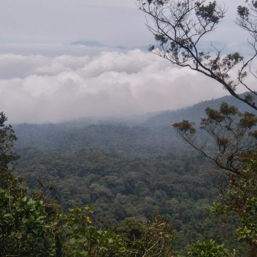
We are lucky; unknowingly we have picked a great day to visit the volcano. As we enter the ranger station the sky is opening up this early morning. It is often hard to avoid walking in the clouds up here in the rainforest. To avoid this foggy climate, as with any volcano, it’s best to visit the Barva as early as possible.
Before we enter the park ($12,- for tourists, $2,- for locals, open from 8 AM – 4 PM daily), we study a sign showing us the incredible amount of animals hidden in the park on the slopes. As we start our hike, it’s easy to imagine all of this rich wildlife secretly staring at us from out of the dense forest, while we pave our way through it.
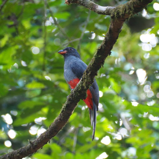
Apparently there are some 515 bird species that inhabit the area, including the goldfinch and quetzal. We see some of them; mainly hummingbirds, flycatchers and a trogon. Less lucky we are with the mammals. The board at the entrance mentioned many of them, such as tapirs, jaguars, pumas, peccaries and the white-faced, red and howler monkeys. Due to its density it can be hard to spot them, so you might consider a ranger for a pair of extra well-trained ears and eyes.
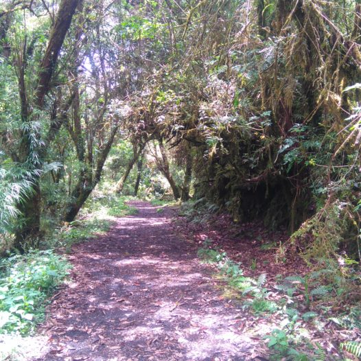
In a tranquil way we hike up the volcano through the lush jungle. Even for a Sunday, the trails are far from crowded. After the first bit up, one can choose from four possible trails. The ‘Cacho De Venado’ is about 1,9 km long and especially attractive for bird watchers. For some great panoramic views you should follow the ‘Mirador Vara Blanca’, roughly 1 km from the main trail.
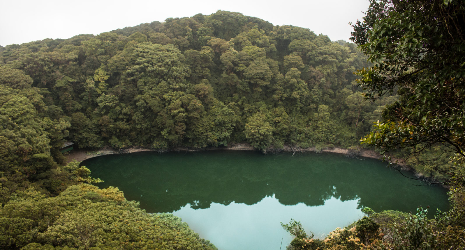
We start with the most popular trail; the one that goes all the way up to the viewing point of the crater. This “Barva Volcano Lagoon” trail is about 3 km long and requires a bit of a trained background or a slow pace. The climbing is absolutely worth it; at the end of the jungle road we’re rewarded with a great overview of the lake, which is surrounded by a dense forest. It is lovely to stare at the lake for a while over here, since the peak is refreshingly cool. Apparently you’re able to see the Pacific coastline on a super bright day too.
The route to Lothlórien
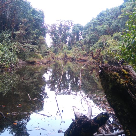
The fourth and last trail leads down to another lake. Route “Laguna Copey” is quite steep and the lake is less impressive than the Laguna Barva, but the 5 km long hike is rather charming nonetheless. The overgrown roads of the Copey route resemble settings of Lord of the Rings, name Rivendell or Lothlórien. Plus it offers some great panoramic views in the meantime of the national park.
As we walk back again to the ranger post, the mist is slowly catching up upon us, creating a mystical atmosphere on this abandoned road. The hummingbirds don’t seem to mind the fog and carry on their way emptying the flowers on the side of the road. I’ve never seen them less shy then up here.
You’ve still got some time left after all these hikes? Keep your ticket, since you are also able to enter the other side of the park with it on the same day! Drive back to San José and all the way up to the busy road 32 that continues to Puerto Limón: it leads you straight through the eastern side of the Braulio Carillo National Park. Once halfway you reach the Quebrada Gonzalez sector, where another rangers station waits for you, offering three short hikes. When the rain isn’t pouring, even driving through this park gives you a magnificent glimpse of its misty surroundings, steep valleys, enormity and pristine state of conservation. An adventure in itself and you don’t even have to leave your car for it. Enjoy your weekend!
